
Locations Koch Construction & Remodeling Serves
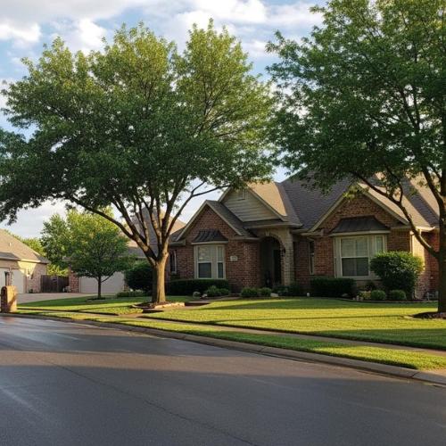
Custom Home Builder Serving Johnson County
We're based in Olathe, KS. We provide custom home builder services across Johnson County and the surrounding metro region. Four primary road corridors connect our crews to every community in our service area. Those corridors are I-35, US-69, K-10, and US-169.
Our work is organized into three core service areas. We handle Custom Home Design Olathe KS, New Home Construction Olathe KS, and Land & Lot Development Olathe KS. Each of those pages covers the full scope of that service from our Olathe base.
Scroll down to find your city. Each city block below lists the local soil conditions, permit office contact, and building code specs for that location.
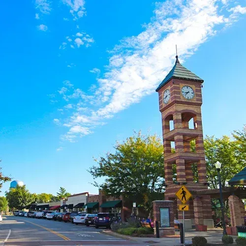
Custom Home Builder in Overland Park, KS
Overland Park is one of the most active custom home markets in Johnson County. Our crews reach the city southbound on US-69 (Metcalf Ave.), entering via the 135th Street exit. Build activity is concentrated around Hallbrook Farms, south of 135th Street near Metcalf Ave.
The Indian Creek Library and Trail System at 151st & Antioch marks the southern edge of our most active Overland Park project zone. Lots in this corridor carry specific soil and code challenges that every builder must address before breaking ground.
Soil & Foundation Conditions
Overland Park is one of the most active custom home markets in Johnson County. Our crews reach the city southbound on US-69 (Metcalf Ave.), entering via the 135th Street exit. Build activity is concentrated around Hallbrook Farms, south of 135th Street near Metcalf Ave.
The Indian Creek Library and Trail System at 151st & Antioch marks the southern edge of our most active Overland Park project zone. Lots in this corridor carry specific soil and code challenges that every builder must address before breaking ground.
Permit Office & Licensing
Permits are pulled through the City of Overland Park Building Safety Division via the ePLACE online portal. The direct line is 913-895-6220. The city has adopted the 2018 IBC. An active Johnson County Contractor License is required before any permit will be issued. Builders working in Blue Valley communities must also obtain HOA Architectural Review approval. That review runs on a separate track from the city permit process.
What We've Seen in the Field
Hallbrook-area lots sit over heavily backfilled farmland. That backfill was often placed without engineered compaction. Wymore-Ladoga clay beneath those lots contracts hard during dry summers. We have documented 3–4 inch seasonal shrink cycles on multiple Hallbrook sites. Managing that movement requires engineered foundation design before a single footing is poured.
Custom Home Builder in Lenexa, KS
Lenexa sits directly north of Olathe on I-35. Our crews access the city via the 87th Street exit heading northbound. Active build corridors include the Mandalay Estates area and the Prairie Star Parkway corridor near 87th Street. The Lenexa Civic Campus at 17101 W. 87th Street Parkway serves as the primary civic landmark in this zone.
Soil & Foundation Conditions
Lenexa sits on dense Wymore-Ladoga clay with a "very high" shrink-swell index rating from USDA-NRCS. Flat plat lots near the Kill Creek watershed drain poorly. Standing water appears on many new lots within 48 hours of a rain event. The 36-inch frost line applies to all footings in this zone. High seasonal rainfall also creates lateral hydrostatic pressure on basement walls. That pressure must be calculated into the foundation wall design on every poured-wall build.
Permit Office & Licensing
Permits route through the City of Lenexa Community Development Department - Planning Division. Planning Division sign-off is a hard prerequisite before any building permit is issued. The plan review fee is calculated at 20% of the total permit fee and is collected at time of submittal. That fee is due before review begins - not after approval.
What We've Seen in the Field
Flat Lenexa lots near Kill Creek don't drain naturally. Clay soil holds water at the surface for days after heavy rain. We install oversized stormwater detention basins and French drain systems on these lots before framing begins. That engineered detention work is a budget and schedule item - not an optional upgrade.
Custom Home Builder in Leawood, KS
Leawood is accessed via US-69 northbound from Olathe. Our crews enter via the 119th to 135th Street exits depending on the lot location.
The Old Leawood and Leawood Homes Association area along the Tomahawk Creek Parkway corridor is the primary residential zone for custom builds. Leawood City Hall at 4800 Town Center Drive serves as the civic landmark for this build zone.
Soil & Foundation Conditions
Leawood sits on dense Wymore-Ladoga montmorillonite clay across the entire build zone. Flat terrain with high groundwater creates aggressive lateral pressure on basement walls. That pressure must be engineered into every poured-wall foundation design. The 36-inch frost line applies to all footings. Portions of the Tomahawk Creek corridor carry periodic 100-year FEMA floodplain overlays. Lots within those overlays require an elevation certificate before any ground disturbance begins.
Permit Office & Licensing
Permits route through the City of Leawood Codes Administration - phone 913-663-9165 or [email protected] - via the Access Leawood portal. Builders in Old Leawood must also obtain Leawood Homes Association Architectural Review Committee approval. That ARC review is a completely separate process from the city building permit. The LHA reviews massing, materials, and window style against Deed Restriction Standards. Leawood's Street Tree Protection Ordinance - effective June 16, 2025 - requires a Tree Protection Zone plan for any new build on a vacant lot.
What We've Seen in the Field
Old Leawood custom builds run on two independent approval tracks at the same time. The city permit process moves on its own schedule. The LHA ARC review moves on a separate schedule with no connection to city timelines. When plans don't meet LHA Deed Restriction Standards on the first submission, the correction cycle adds 6–10 weeks to preconstruction. We submit LHA documents and city permit applications in parallel to limit that exposure.
Custom Home Builder in New Century, KS
New Century is accessed via I-35 southbound to the S. Kansas Ave. / Gardner-New Century exit. Our crews drive in via S. Keeler Street to reach the Moonlight Road corridor and the large rural lots on the residential fringe of New Century AirCenter. The AirCenter itself - the former USAF Richards-Gebaur Airport at 15670 S. Keeler St. - is the primary landmark for this build zone.
Soil & Foundation Conditions
New Century lots sit on former Wymore-Ladoga farmland clay. Decades of agricultural tilling have left the topsoil layer loose and poorly compacted. Compaction testing is required on any backfilled agricultural lot before footings are placed. Public sewer is not available - every lot in this area requires a private septic system. The 36-inch frost line applies to all footings. Open rural terrain in this corridor also places every new structure in the 90 mph sustained wind-load design zone.
Permit Office & Licensing
New Century is unincorporated Johnson County. All building permits route through Johnson County Planning & Building Codes at 111 S. Cherry St., Suite 2000, Olathe, KS - phone 913-715-2200. Any property without platting and annexation cannot access city utility connections. A Johnson County entrance and driveway permit through Johnson County Public Works at 913-715-8300 is required for the first structure placed on any rural lot.
What We've Seen in the Field
Former cropland in New Century carries a soil compaction problem that is not visible at the surface. Tilling over many seasons breaks up the natural soil structure to 12–18 inches deep. We coordinate private well and septic installation alongside site grading on these lots. Engineered compaction testing must be completed and documented before we pour a single footing. Skipping that step on agricultural land creates long-term foundation settlement risk.
Custom Home Builder in Stilwell, KS
Stilwell is reached via US-69 southbound from Olathe. Our crews turn off between the 175th and 199th Street exits depending on the lot location. The Kill Creek Park Equestrian Trailhead at the Antioch Road entrance is the primary landmark for this build zone. Large acreage lots in Wolf Valley Estates off 199th Street represent the core residential corridor here.
Soil & Foundation Conditions
Stilwell lots on rolling terrain frequently hit a limestone shelf at 2–4 feet below grade. Wymore clay caps that limestone outcrop on most hillside lots. Standard footing trenches cannot be excavated through limestone with conventional equipment. Rock-cutting is required before footings can be placed. The 36-inch frost line applies to all footings in this zone. North-facing grades carry elevated frost heave risk due to reduced sun exposure in winter. All structures also fall within the 90 mph wind-load design zone.
Permit Office & Licensing
Stilwell is unincorporated Johnson County. All building permits route through Johnson County Planning & Building Codes at 111 S. Cherry St., Suite 2000, Olathe, KS - phone 913-715-2200. Septic permits are handled separately through the Johnson County Environmental Department at 913-715-6900. Any new driveway or entrance requires a separate permit through Johnson County Public Works at 913-715-8300. That is three separate permit tracks before a footing can be inspected.
What We've Seen in the Field
Limestone shelves on sloped Stilwell lots show up at 2–3 feet below grade without warning. When that happens, standard poured footings are no longer an option. We switch to helical piers driven past the rock shelf to load-bearing soil below. That foundation change adds 3–5 weeks to the foundation phase. Identifying limestone risk before excavation begins is a standard part of our Stilwell pre-construction process.
Custom Home Builder in Gardner, KS
Gardner is accessed via I-35 westbound from Olathe. Our crews enter via the US-56 (Main Street) Gardner exit. Active build corridors are centered around the Heritage Park subdivision area near Waverly Road and 183rd Street. Prairie River Park at Waverly Rd. and Center St. is the primary landmark for this build zone.
Soil & Foundation Conditions
Gardner lots on the north side sit on Wymore-Ladoga clay over rolling former farmland. Lots near the Miami County line to the south transition into sandy loam. That sandy loam carries a lower bearing capacity than the clay north of it. Recently platted agricultural land in this corridor requires complex site grading before any foundation work begins. The 36-inch frost line applies to all footings. Heavy spring rain runoff on flat new plats is a consistent drainage challenge. All structures fall within the 90 mph wind-load design zone.
Permit Office & Licensing
Permits route through the City of Gardner Building & Inspections at City Hall, 120 E. Main Street, Gardner, KS 66030 - Community Development Department. Gardner requires all property to be fully platted before any building permit is issued. That is a hard legal requirement - not a soft guideline. Annexation must also be completed before city utility services are available on any lot.
What We've Seen in the Field
The Gardner platting-first rule is the single biggest schedule factor in this city. Unplatted lots must complete the full Preliminary Plat, Final Plat, and annexation process with the Gardner Planning Commission. That process adds 4–8 weeks to the project timeline before a single permit application can be filed. Builders who don't account for that lead time in their client contracts create avoidable schedule conflicts.
Custom Home Builder in Spring Hill, KS
Spring Hill is accessed via US-169 (Metcalf extension) southbound from Olathe. Our crews enter directly via 223rd Street. Active build corridors include Willow Creek Estates and the Countryside subdivision on the south side of the city. The Spring Hill Aquatic Center in the 16th Street Park area serves as the primary civic landmark for this build zone.
Soil & Foundation Conditions
Spring Hill carries two distinct soil profiles depending on lot location. North Spring Hill sits on Wymore-Ladoga clay on the Johnson County side. South Spring Hill transitions into a Miami County clay-loam mix with a different load-bearing capacity on each side of the county line. The 36-inch frost line applies to all footings on both sides. Spring tornado risk in this corridor makes FEMA-compliant safe room consideration a standard part of every new build discussion.
Permit Office & Licensing
Permits route through the City of Spring Hill Community Development Department at 401 N. Madison St., Spring Hill, KS 66083 - via the E-Permits portal for all new construction. Spring Hill accepts either a Johnson County OR a Miami County contractor license. That dual-county acceptance reflects the city's physical location straddling the county line. All setbacks and lot coverage standards are governed by the 2016 Spring Hill Zoning Ordinance.
What We've Seen in the Field
The county line runs through the middle of Spring Hill. A custom home on the south side of that line may require a Miami County contractor license instead of a Johnson County license. Those two lots can be less than half a mile apart. Builders who hold only a Johnson County license cannot legally pull a permit on the Miami County side without a second license. We maintain both credentials to avoid that stop-work exposure.
Custom Home Builder in Shawnee Mission, KS
Shawnee Mission is accessed via I-35 northbound from Olathe. Our crews enter via the Shawnee Mission Parkway or 87th Street exits. Active build corridors in this postal district include the Prairie Star area near the south Overland Park and Lenexa border along 87th Street Pkwy. Shawnee Mission Park at 7900 Renner Road - the largest park in Johnson County - is the primary landmark for this build zone.
Soil & Foundation Conditions
rates this soil complex at "very high" for shrink-swell behavior throughout. Terrain is flat to gently rolling across most of the district. High groundwater tables are common in the north Johnson County flat zones. The 36-inch frost line applies to all footings. All structures fall within the 90 mph wind-load design zone.
Permit Office & Licensing
Shawnee Mission is a postal district - not a single municipality. Permit authority depends entirely on the physical address of the lot. Addresses in the Overland Park portion route to the City of Overland Park Building Safety Division at 913-895-6220. Addresses in the Lenexa portion route to the City of Lenexa Community Development Department. Addresses in the Shawnee portion route to the City of Shawnee Building Codes Division at 913-742-6010. Jurisdiction must be confirmed by physical address before any permit application is submitted. Multiple HOAs in this district also require Architectural Review Board approval on a separate track.
What We've Seen in the Field
The Shawnee Mission ZIP code spans three separate cities with three different permit portals, fee schedules, and code cycles. Submitting to the wrong city's office is a recoverable mistake - but it costs 4–6 weeks before the error surfaces at plan review. We verify the controlling jurisdiction by parcel address before any preconstruction work begins on a Shawnee Mission lot.
Custom Home Builder in Bucyrus, KS
Bucyrus is accessed via US-169 southbound from Olathe. Our crews turn off between the 255th and 279th Street rural turnoffs depending on the lot location. Build activity in this area centers on large acreage parcels east of US-169 along long Bucyrus Road lots ranging from 5 to 20 acres. The Prairie Spirit Trail State Park trailhead near the Bucyrus terminus marks the southern edge of this build zone.
Soil & Foundation Conditions
Bucyrus lots sit on Wymore-Ladoga clay over rolling grassland terrain. A perched water table is common on low-lying lots throughout this corridor. Expanding clay beneath shallow topsoil creates foundation heave risk on flat building pads. The 36-inch frost line applies to all footings. Rural open-field exposure places every new structure in the 90 mph wind-load design zone. Tornado shelter planning is a standard discussion item on large custom builds in this area.
Permit Office & Licensing
Bucyrus is unincorporated Johnson County. All building permits route through Johnson County Planning & Building Codes at 111 S. Cherry St., Suite 2000, Olathe, KS - phone 913-715-2200. Septic permits are handled separately through the Johnson County Environmental Department at 913-715-6900. Driveway and entrance permits route through Johnson County Public Works at 913-715-8300. Minimum lot size compliance must also be confirmed before any permit application is accepted. Public water and sewer are not available on most Bucyrus parcels.
What We've Seen in the Field
High clay content and a perched water table on Bucyrus lots create a specific septic system problem. A conventional gravity septic system cannot function in saturated clay soil with a shallow water table. We regularly encounter lots that require an engineered elevated mound system or an aerobic treatment unit instead. That upgrade adds $15,000–$25,000 to the site preparation budget. Identifying that condition during soil evaluation - before purchase - is the most cost-effective step a Bucyrus buyer can take.
Custom Home Builder in Kansas City, MO
Kansas City, MO is accessed via I-35 eastbound across the state line from Olathe. Our crews enter via the Broadway/downtown corridor or US-169 northbound depending on the build location. Active custom home corridors include the Staley Farms and Briarcliff West areas near the I-435 and US-169 interchange in north KC. Kansas City International Airport at 1 Kansas City Blvd. serves as the primary landmark for this build zone.
Soil & Foundation Conditions
Northern Kansas City sits on loess - wind-deposited silt - layered over Wymore clay. The USDA-NRCS rates this combined profile as "high" for shrink-swell behavior. Flood plain parcels near the Missouri River carry alluvial soils with active settling risk. The 36-inch frost line applies to all footings in this zone. FEMA Special Flood Hazard Area overlays run along the Missouri River corridor. Any structure within those overlays requires an elevation certificate before ground disturbance begins. All new structures in Kansas City, MO have required a sealed stake-out land survey by a Missouri-licensed surveyor at permit submittal since January 1, 2024.
Permit Office & Licensing
Permits route through the KCMO City Planning & Development Department - Permits Division on the 5th Floor of City Hall at 414 E. 12th St., Kansas City, MO 64106 - via the CompassKC online portal - phone 816-513-1500. The city has adopted the 2012 IBC. All plot plans must be drawn, signed, and sealed by a Missouri-licensed architect or engineer. That sealed plot plan requirement does not exist on the Kansas side of the state line. A sealed stake-out survey is also required with every new residential permit application since January 2024.
What We've Seen in the Field
Kansas-based builders entering KCMO for the first time encounter Missouri-side engineering requirements that have no equivalent in Johnson County. A sealed plot plan and a staked survey both require a Missouri-licensed architect or engineer. Arranging those credentials after permit submittal adds 2–3 weeks to the project start. We coordinate Missouri-licensed engineering contacts before any KCMO permit application is filed.
Custom Home Builder in Shawnee, KS
Shawnee is accessed via I-35 northbound from Olathe. Our crews enter via the Johnson Drive (K-7) east exit or K-32 west depending on the lot location. Active build corridors include the Westbrooke and Glenbrook subdivision areas near the K-7 and Johnson Drive corridor. Shawnee Town 1929 Living History Museum at 11600 Johnson Drive serves as the primary landmark for this build zone.
Soil & Foundation Conditions
Shawnee sits on Wymore-Ladoga montmorillonite clay across most of its build zone. North Shawnee lots near Kill Creek have shallow rock outcrops that affect footing depth and excavation cost. South Shawnee lots are flatter with deeper clay and fewer rock encounters. The city has adopted the 2018 IRC. The 36-inch frost line applies to all footings. All structures fall within the 90 mph wind-load design zone. Underground utility TV services are required by Shawnee Municipal Code on all new builds.
Permit Office & Licensing
Permits route through the City of Shawnee Building Codes Division at 11110 Johnson Drive, Shawnee, KS 66203 - email [email protected] - phone 913-742-6010. An active Johnson County Contractor License is required before any permit is issued. A final Certificate of Occupancy will not be issued until an as-built drawing and certification is submitted to Shawnee Codes Administration. That document must be signed by the builder and sealed by a Kansas-licensed engineer. It must confirm that lot grading and drainage meet code standards before CO issuance.
What We've Seen in the Field
The Shawnee as-built grading certification requirement catches builders off guard at the finish line. A home can pass every framing, mechanical, and final inspection - and still not receive a CO. The sealed engineer's certification on lot grading is a separate document with its own submission and review process. Builders who don't budget for that engineering step hold up client move-in dates. We schedule the grading certification well before the final inspection request.
Custom Home Builder in Prairie Village, KS
Prairie Village is accessed via US-69 northbound from Olathe. Our crews enter via the 75th Street or 95th Street exits depending on the lot location. Active build corridors include the Canterbury Drive and Mission Road corridor near 75th Street - a dense infill zone of 1950s-era lots. Harmon Park at 7101 Mission Road serves as the primary landmark for this build zone.
Soil & Foundation Conditions
Prairie Village sits on dense Wymore-Ladoga clay across its entire build footprint. The USDA-NRCS rates this soil complex at "very high" for shrink-swell behavior. Flat terrain slows surface drainage significantly. After heavy rain events, groundwater tables rise to within 3–4 feet of grade on north section lots. That seasonal groundwater rise creates persistent lateral pressure on existing block foundations. The 36-inch frost line applies to all footings throughout the city.
Permit Office & Licensing
Permits route through the City of Prairie Village Community Development Department - email [email protected] - phone 913-385-4604 - via the OpenGov portal. General contractors must hold two separate active licenses before any permit is issued. The first is a Johnson County Contractor License. The second is a separate Prairie Village city contractor license. Those are two distinct registrations with two separate credential processes. Neither license substitutes for the other.
What We've Seen in the Field
Prairie Village infill lots run 55–65 feet wide. Mature tree root zones on those lots routinely extend under neighboring property lines. Builders must manage Prairie Village tree protection code, applicable HOA covenants, and 6-foot side setbacks at the same time. A root zone conflict with a neighbor's protected tree can pause excavation until an arborist certifies the impact. We map root zones and setback lines before any site preparation begins on Prairie Village infill lots.
Custom Home Builder in Mission, KS
Mission is accessed via I-35 northbound from Olathe through the Shawnee Mission Parkway corridor. Our crews enter via Johnson Drive westbound to reach the Lamar Ave corridor and the Foxridge area near Johnson Drive and Nall Ave. The South Ridge Civic Center and Mission Road corridor at 50th & Mission Road serves as the primary landmark for this build zone.
Soil & Foundation Conditions
Mission sits on dense Wymore-Ladoga clay across a flat Johnson County terrain profile. This is one of the oldest residential districts in Johnson County - lots date to the 1940s. Pre-code fill practices on those older lots may have introduced soil contamination from miscellaneous debris used as grading material. Flat urban terrain limits stormwater infiltration on every lot. Builders must manage 100% of on-site runoff before tying into the city storm system. The 36-inch frost line applies to all footings throughout the city.
Permit Office & Licensing
Permits route through the City of Mission Building Services, Community Development Department - phone 913-676-8350. Mission works in conjunction with Johnson County for code enforcement on new residential construction. Infill demolition and rebuild projects require three separate approvals before a new home permit is issued. Those three items are a demolition permit, a site plan, and a stormwater management plan. All three must be in hand before new construction permitting begins.
What We've Seen in the Field
Mission's 1940s and 1960s infill lots carry a specific excavation risk. Pre-code rubble fill - crushed brick, ash, and miscellaneous construction debris - was commonly used as lot grading material during that era. That material shows up during footing excavation without warning. It must be fully removed and replaced with engineered fill before footings are placed. That discovery and replacement process delays foundation start by 2–3 weeks on affected lots.
Custom Home Builder in De Soto, KS
De Soto is accessed via K-10 (US-56) westbound from Olathe. Our crews enter via the Lexington Ave. exit at the K-10 junction. Active build corridors include the Regency Park and Clear Creek Estates areas near K-10 and Lexington Avenue. Lexington Lake Park at 35350 W. 87th Street serves as the primary landmark for this build zone.
Soil & Foundation Conditions
De Soto sits in a western Johnson County transition zone. North lots carry primarily Wymore clay. Lots south of K-10 transition into pockets of sandy loam with a lower bearing capacity of approximately 1,500 psf - compared to 2,000 psf on standard clay. De Soto also sits in a shallow valley where cold air pools in winter months. Frost risk in this zone extends 2–3 additional weeks into spring compared to flat Johnson County locations. The 36-inch frost line applies to all footings throughout the city.
Permit Office & Licensing
Permits route through the City of De Soto Building & Codes Department - phone 913-586-5277 - via the desotoks.us permit portal. Lots without access to public sewer require a septic installation permit through the Building Inspection Department before any ground disturbance begins. Private wastewater systems on any De Soto property must be inspected within 30 days of any property transfer. That inspection requirement applies regardless of when the system was originally installed.
What We've Seen in the Field
De Soto lots near K-10 present a drainage problem that is not visible at the surface. Sandy topsoil appears free-draining on inspection. Dense clay begins at 18–24 inches below grade on many of those same lots. That clay layer acts as an impermeable barrier - trapping moisture in the sandy topsoil zone above it. The result is a chronic wet crawlspace and basement condition. We install engineered grading and interior drain tile on every De Soto lot where that layered profile is confirmed during soil evaluation.
Custom Home Builder in Hillsdale, KS
Hillsdale is accessed via US-169 southbound from Olathe past Bucyrus, then west on K-68 to Hillsdale Road. Our crews turn off at Hillsdale Road to reach the rural acreage parcels near the K-68 corridor on the Miami County agricultural fringe. Hillsdale Lake and Miami County State Park at 26001 W. 255th St. in the Paola area serves as the primary landmark for this build zone.
Soil & Foundation Conditions
Hillsdale sits on a Miami County clay-loam mix with moderate shrink-swell behavior - less aggressive than the Wymore-Ladoga complex found across most of Johnson County. Shallow rock appears near creek drainages throughout the area. Agricultural topsoil has been stripped from many parcels by prior farming operations. That stripped topsoil condition requires engineered fill and compaction testing before footings are placed. Wells in this area commonly reach 80–140 feet in depth. Public water is not available on most Hillsdale rural parcels. The 36-inch Kansas statewide frost line applies to all footings.
Permit Office & Licensing
Hillsdale is unincorporated Miami County. Permits route through the Miami County Building & Zoning Department at the Miami County Courthouse, 201 S. Pearl St., Paola, KS 66071 - phone 913-294-3976. Miami County requires Miami County contractor licensing for all permitted work. A Johnson County Contractor License does not satisfy that requirement. The Miami County permit office is located in Paola - approximately 25 minutes from Hillsdale. Review timelines run longer than the digital system used across Johnson County jurisdictions.
What We've Seen in the Field
Builders who regularly work in Johnson County are not set up for the Miami County permit process. The contractor licensing application, the paper-based plan review, and the Paola office location all operate differently from any JoCo system. That unfamiliarity adds 6–8 weeks to preconstruction on a first Hillsdale project. We maintain active Miami County contractor licensing and account for that review timeline in every Hillsdale project schedule from day one.
Custom Home Builder in Belton, MO
Belton is accessed via I-49 (US-71) southbound from the Kansas City state line. Our crews enter via the Belton and Raymore exits between 155th and 163rd Streets - south of I-470. Active build corridors include the south Belton new development area near I-49 and 163rd Street on the Cass County edge. Belton Regional Medical Center at 17065 S. 71 Highway serves as the primary landmark for this build zone.
Soil & Foundation Conditions
Belton sits on a Cass County variant of Wymore-Ladoga clay over rolling terrain. New subdivision lots in this corridor are built on former Cass County farmland. Soil compaction testing is required on all former farmland lots before footings are placed. The Missouri frost line minimum is 32 inches - 4 inches shallower than the Kansas statewide standard of 36 inches. Builders crossing the state line must recalculate footing depth on every Missouri-side project. That 4-inch difference is a hard code requirement - not a field judgment call.
Permit Office & Licensing
Permits route through the City of Belton Community Development Department - Planning, Building, and Neighborhood Improvement Division - at 506 Main Street, Belton, MO 64012 - via the belton.org portal. All plans must comply with both the 2012 International Codes and the Belton Unified Development Code, Chapter 10. Any land disturbance over 1 acre triggers a Missouri DNR stormwater permit. That DNR permit is submitted separately from the city building permit. New custom home sites commonly exceed the 1-acre disturbance threshold.
What We've Seen in the Field
The Missouri DNR Land Disturbance Permit on Belton lots over 1 acre requires a State-approved Stormwater Pollution Prevention Plan - commonly called an SWPPP. Most Kansas-based builders have never prepared an SWPPP for a residential project. That unfamiliarity adds cost and a 4–6 week regulatory delay before any ground disturbance can begin. We coordinate Missouri DNR compliance documentation before any Belton permit application is submitted.
Custom Home Builder in Grandview, MO
Grandview is accessed via I-435 eastbound from Olathe, then south on US-71 (I-49). Our crews enter via the Grandview exits at Byars Road or Blue Ridge Boulevard depending on the lot location. Active build corridors include the Sni-A-Bar Creek and Byars Road corridor in east Grandview - a growing residential area near US-71. Grandview Community Center at 13600 Main Street serves as the primary landmark for this build zone.
Soil & Foundation Conditions
Grandview sits on southern Jackson County Wymore clay with a "high" shrink-swell rating. Sloped terrain near the US-71 interchange creates drainage toward foundations on downhill lots. That drainage pattern must be addressed in the site grading plan before footings are placed. FEMA floodplain overlaps are present near Sni-A-Bar Creek drainage areas. The Missouri frost line minimum of 32 inches applies to all footings - 4 inches shallower than the Kansas 36-inch standard. Builders must adjust footing depth calculations on every Missouri-side project.
Permit Office & Licensing
Permits route through the City of Grandview Community Development Department - Building Services Division - phone 816-316-4817. The Building Official line is 816-316-4825. Missouri state law requires all new one- and two-family dwelling plot plans to be drawn, signed, and sealed by a Missouri-licensed architect, engineer, or land surveyor. That sealed plot plan is a hard state requirement on every Grandview new home permit. New regulations also require all landscaping to be installed on the builder's own property - not in the public right-of-way.
What We've Seen in the Field
Kansas-based builders entering Grandview for the first time encounter the Missouri sealed plot plan requirement without warning. That document does not exist in any Kansas permit process. Arranging a Missouri-licensed surveyor or engineer after permit submittal adds weeks to the project start. The right-of-way landscaping restriction also adds grading complexity on sloped Grandview lots where builders instinctively grade toward the street. We coordinate Missouri-licensed engineering and grading plans before any Grandview permit application is filed.
Custom Home Builder in Clearview City, KS
Clearview City is accessed via I-35 northbound from Olathe to Shawnee Mission Parkway, then west to Quivira Road. Our crews reach the area via Quivira Road north to the rural single-family parcels along the 103rd Street corridor. The western boundary of Shawnee Mission Park at 6501 W. 79th Street in the Shawnee area serves as the primary landmark for this build zone.
Soil & Foundation Conditions
Clearview City sits on north Johnson County Wymore-Ladoga clay complex across flat terrain. The groundwater table runs close to the surface throughout this area. In wet seasons, that groundwater rises aggressively - creating lateral pressure on basement walls that must be engineered into every poured-wall foundation design. Waterproofing design is not optional on any poured-wall foundation in this zone. The 36-inch frost line applies to all footings. High groundwater during wet seasons elevates basement moisture risk on every affected lot.
Permit Office & Licensing
Clearview City is unincorporated Johnson County. All building permits route through Johnson County Planning & Building Codes at 111 S. Cherry St., Suite 2000, Olathe, KS - phone 913-715-2200. No city zoning applies - builders follow Johnson County Unincorporated Area zoning regulations adopted March 17, 1994. Septic permits route separately through the Johnson County Environmental Department at 913-715-6900. Many Clearview City parcels rely on private water connections rather than public water service.
What We've Seen in the Field
Clearview City's unincorporated status means no city water or sewer on most parcels. Full well, septic, and site grading coordination runs entirely through county-level permits on three separate tracks. Wet Wymore clay on excavated basements in this zone holds groundwater against the foundation wall during the construction window. A dewatering pump is required on most excavated basements before a footing inspection can be scheduled. Skipping that step delays the inspection and risks undermining freshly placed footings.
Custom Home Builder in Edgerton, KS
Edgerton is accessed via I-35 westbound from Olathe to the K-33 Edgerton exit, then north on S. Clare Road. Our crews reach active build corridors in the Dwyer Farms PUD - a 279-lot planned community on single-family lots north of I-35. The BNSF Logistics Park and New Century AirCenter adjacent area along S. Clare Road at I-35 serves as the primary landmark for this build zone.
Soil & Foundation Conditions
Edgerton sits on former agricultural clay loam on the flat I-35 corridor. Wymore clay forms the base layer beneath stripped agricultural topsoil on most lots. Compaction issues from prior farming operations are common throughout the corridor. Rock removal was required in some areas during Dwyer Farms Phase 1 infrastructure installation - including the use of a blasting permit. Low-frequency vibration from adjacent BNSF rail traffic is a site-specific structural consideration for foundations near the rail yard perimeter. The 36-inch frost line applies to all footings. All structures fall within the 90 mph wind-load design zone.
Permit Office & Licensing
Permits route through the City of Edgerton Community Development Department at 404 E. Nelson Street, Edgerton, KS - via the edgertonks.org online permit portal. Edgerton requires potable water verification before any building permit is issued. Applicants must present a water connection permit or written confirmation of water service availability at time of submittal. All Dwyer Farms lots must also comply with the approved PUD Conceptual Plan conditions adopted by the Edgerton Planning Commission.
What We've Seen in the Field
Custom homes adjacent to the BNSF Edgerton intermodal facility face an ongoing low-frequency rail vibration challenge during the concrete curing phase. Slab and footing crack patterns have been observed near the rail yard perimeter on previously completed builds. Some clients in Dwyer Farms Phase 2 have requested vibration monitoring throughout the full foundation work window. We document vibration exposure and adjust concrete cure scheduling on lots within the identified perimeter zone.
Custom Home Builder in Edwardsville, KS
Edwardsville is accessed via I-70 eastbound from Olathe or K-7 northbound to I-70. Our crews enter via the 78th Street/Edwardsville exit. Active build corridors include the Weaver Heights and Riverview area near I-70 and 78th Street - situated close to the Kansas River bottom. Wyandotte County Lake Park at the 91st Street entrance in Wyandotte County serves as the primary landmark for this build zone.
Soil & Foundation Conditions
Edwardsville sits on western Wyandotte County alluvial clay near the Kansas River flood plain. Alluvial soils in this zone are prone to both settling and saturation depending on seasonal conditions. FEMA Special Flood Hazard Areas are mapped near river bottom lots throughout this corridor. Any structure within those flood hazard areas requires an elevation certificate before any ground disturbance begins. The 36-inch frost line applies to all footings. All structures fall within the 90 mph wind-load design zone.
Permit Office & Licensing
Permits route through the City of Edwardsville Planning & Development at City Hall - phone 913-356-6012. Flood plain questions and Floodplain Development Permits route separately to Wyandotte County Planning & Zoning - phone 913-573-5750. Any construction in or near a FEMA-regulated flood plain requires a Floodplain Development Permit before any ground disturbance begins. That permit triggers FEMA-compliant elevation requirements. A full elevation certificate may be required on affected lots before construction can proceed.
What We've Seen in the Field
Edwardsville lots near the Kansas River bottom sit on alluvial soils with no predictable bearing capacity. Soft, saturated clay mixed with river-deposited sand can shift during wet seasons without warning. Standard poured footings cannot reach load-bearing strata on those lots. We drive steel helical piers to load-bearing strata 20–30 feet below grade on confirmed alluvial lots. That foundation method replaces conventional footings entirely on the most affected river bottom parcels.
Custom Home Builder in Bonner Springs, KS
Bonner Springs is accessed via I-70 westbound from Olathe or I-435 northbound to K-7. Our crews enter via the Bonner Springs exit at Parallel Parkway. Active build corridors include the Eagle Ridge and Riverview Estates areas in north Bonner Springs near Parallel Pkwy and I-70. Wyandotte County Lake Park and the Bonner Springs Community Center at 200 E. Third St. serve as the primary landmarks for this build zone.
Soil & Foundation Conditions
Bonner Springs sits on heavy Wymore clay in the western Wyandotte and eastern Leavenworth County transition zone. Lots near the Kansas River bottom transition toward alluvial soils prone to seasonal saturation. Riverfront lots in this corridor carry active moisture risk during wet seasons. The 36-inch frost line applies to all footings. Kansas River proximity creates Class A and Class B flood zone overlays on lower-elevation lots. All new residential electrical service must be installed underground per Bonner Springs city code. All structures fall within the 90 mph wind-load design zone.
Permit Office & Licensing
Permits route through the City of Bonner Springs Community & Economic Development Department at 200 E. Third Street, Bonner Springs, KS 66012 - phone 913-667-1710. Bonner Springs requires every contractor AND every subcontractor to hold a Bonner Springs city contractor license before working on any permitted project. That city license is a completely separate credential from a Johnson County or Wyandotte County contractor license. Neither of those county licenses satisfies the Bonner Springs city requirement. Underground electrical service is required on all new residential builds under city code.
What We've Seen in the Field
Builders entering Bonner Springs from Johnson County routinely underestimate the subcontractor licensing requirement. Every sub on the job - framing, mechanical, electrical, plumbing - must hold an active Bonner Springs city license before permit issuance. Using an unlicensed subcontractor in Bonner Springs triggers a stop-work order even if that sub holds a valid Olathe or Overland Park license. We verify active Bonner Springs city credentials for every subcontractor before any permit application is submitted.
Custom Home Builder in Cleveland, MO
Cleveland is accessed via I-49 (US-71) southbound from the Kansas City metro to the Cleveland/Freeman exit, then via Outer Road or MO-2. Our crews reach rural estate parcels south of Cleveland on the Cass County agricultural fringe - large lots ranging from 5 to 20 acres. The South Grand River corridor and Lake Viking area in northern Cass County serve as the primary landmarks for this build zone.
Soil & Foundation Conditions
Cleveland sits on Cass County clay loam over rolling Missouri Ozark fringe topography. This soil profile carries moderate shrink-swell behavior. Steep drainage grades on hillside lots create active runoff challenges that must be addressed in the site grading plan. Agricultural topsoil has been stripped from most residential parcels converted from farmland. That stripped condition requires engineered fill and compaction testing before footings are placed. The Missouri frost line minimum of 32 inches applies to all footings - 4 inches shallower than the Kansas standard. Open-field rural exposure in this corridor requires 90 mph wind-load design on every new structure. Tornado risk is high throughout this rural Cass County corridor.
Permit Office & Licensing
Cleveland is primarily unincorporated Cass County. All building permits route through the Cass County Building Codes Department at 102 E. Wall, Harrisonville, MO 64701 - phone 816-380-8100. Cass County operates a paper-based building code administration process. Applications are submitted in person or by mail in Harrisonville - not through an online portal. Any land disturbance over 1 acre requires a separate Missouri DNR stormwater permit submitted independently from the county building permit. Both the county permit and the DNR permit must be in hand before ground disturbance begins.
What We've Seen in the Field
Cleveland's rural Cass County lots sit on rolling terrain with active drainage courses across 5–20 acre parcels. Comprehensive site grading plans across that acreage require more design time than a standard suburban lot. The county's paper-based review process means plan correction cycles take weeks rather than days. A single correction request from the Harrisonville office resets the review clock by 3–4 weeks. We complete full site grading design and Missouri DNR documentation well in advance of any desired project start date on every Cleveland build.
Johnson County Custom Home Builder Requirements
Every custom home project in the Johnson County metro operates under a layered set of regional standards. Those standards apply regardless of which city or unincorporated area the lot sits in. Understanding them before preconstruction begins is the most direct way to protect a project schedule.
Johnson County Contractor Licensing
All contractors must hold an active Johnson County Contractor License before any permit is issued in any incorporated Johnson County city. That requirement is enforced across Overland Park, Lenexa, Leawood, Shawnee, Prairie Village, and Mission. Some cities add a second city-specific license on top of the county credential. Prairie Village requires both a Johnson County license and a separate Prairie Village city license. Bonner Springs requires a separate city license for every contractor and every subcontractor on the job.
Regional Frost Line Standard
The Kansas statewide frost line is 36 inches. That depth applies uniformly across every Johnson County jurisdiction and drives minimum footing depth on all new construction. Missouri-side cities in this service area - Belton, Grandview, Kansas City MO, and Cleveland - follow the Missouri frost line of 32 inches. That 4-inch difference must be tracked and recalculated on every project that crosses the state line.
Regional Wind-Load Standard
All Johnson County jurisdictions and adjacent metro-area cities fall within the 90 mph sustained wind-load design zone. That standard governs roof framing, shear wall design, and structural connection specifications on every new build in this service area. It applies on both sides of the state line.
Wymore-Ladoga Clay - Regional Soil Baseline
The dominant soil complex across Johnson County is Wymore-Ladoga montmorillonite clay. The USDA-NRCS rates this complex as "very high" for shrink-swell behavior. That single geological factor drives the need for engineered foundations, 36-inch frost footings, and waterproofed basement walls on virtually every Johnson County custom home project. Builders who don't account for seasonal shrink-swell cycles in their foundation design create long-term structural risk for their clients.
FEMA Flood Plain Awareness
Multiple communities in this service area carry FEMA Special Flood Hazard Area designations. Those communities include Leawood along the Tomahawk Creek corridor, Edwardsville, Kansas City KS, Kansas City MO, and Bonner Springs near the Kansas River bottom. Elevation certificates and Floodplain Development Permits are required before any ground disturbance on lots within those designated areas. Flood plain status must be confirmed at the parcel level before any site work is planned.
State-Line Code Divergence
Missouri-side communities in this service area require plot plans sealed by a Missouri-licensed architect or engineer. Kansas does not carry that requirement. Missouri DNR Land Disturbance Permits trigger on any lot over 1 acre of ground disturbance - a threshold commonly reached on new custom home sites. Both the sealed plot plan and the DNR permit add preconstruction lead time on every Missouri-side project. Builders must account for both before scheduling a Missouri-side project start date.
Unincorporated County Jurisdictions
Several communities in this service area fall under Johnson County Planning & Building Codes at 111 S. Cherry St., Suite 2000, Olathe, KS - phone 913-715-2200 - rather than any city permit office. Those communities include Stilwell, New Century, Bucyrus, and Clearview City. Septic permits on those parcels route through the Johnson County Environmental Department at 913-715-6900. Driveway and entrance permits route through Johnson County Public Works at 913-715-8300. Each of those three permit tracks runs independently and must be coordinated before any footing work begins.
Johnson County Custom Home Builder - Frequently Asked Questions
What areas do you serve for custom home building?
We build across Johnson County, KS and the surrounding metro, including Olathe, Overland Park, Lenexa, Leawood, Shawnee, Prairie Village, Mission, Gardner, Spring Hill, Stilwell, Bucyrus, New Century, and into Missouri cities like Kansas City, Belton, and Grandview.
Do you help with land evaluation before building?
Yes. We evaluate soil conditions, drainage, compaction, and permitting constraints before construction begins. This prevents costly delays and structural issues later.
How long does it take to build a custom home?
Timelines vary by location, permitting, and site conditions. Preconstruction alone can add 4 to 10+ weeks depending on approvals, soil issues, and jurisdiction requirements.
Do I need a contractor license to build in Johnson County?
Yes. A valid Johnson County Contractor License is required before any permit is issued in incorporated cities.
Are permits different in each city?
Yes. Each city has its own permit office, process, fees, and timelines. Some also require HOA or architectural review approvals separate from city permits.
What is different about building in Missouri vs Kansas?
Key differences include:
Missouri requires sealed plot plans by licensed professionals
Missouri frost line is 32 inches vs 36 inches in Kansas
State stormwater permits may apply on larger sites
Do unincorporated areas have different requirements?
Yes. Areas like Stilwell, Bucyrus, and New Century require:
County building permits
Separate septic permits
Separate driveway permits
What type of soil is common in Johnson County?
Most of the region sits on Wymore-Ladoga clay, which has very high shrink-swell behavior and requires engineered foundations.
Why is soil testing important before building?
Soil conditions can cause:
Foundation movement
Drainage problems
Structural failure
Testing ensures proper design before construction begins.
What foundation issues are common in this area?
Common challenges include:
Expanding clay causing movement
Poor drainage and standing water
Limestone rock layers blocking excavation
Backfilled farmland with poor compaction
Do all homes require engineered foundations?
In most cases, yes. Soil conditions in this region make engineered foundation design essential for long-term stability.
Do all lots have access to sewer and utilities?
No. Rural and unincorporated areas often require:
Septic systems
Private wells
Additional permits for utilities
Can farmland be used for home building?
Yes, but former agricultural land often requires:
Compaction testing
Soil stabilization
Grading improvements
Monday - Friday: 8am - 5pm
Saturday & Sunday: Closed
Serving the Kansas City Metro Area
Picture This Video proudly serves families and businesses throughout the Kansas City metropolitan area. Our Belton location is conveniently located for customers in Kansas City, Missouri, Olathe, Kansas, and all surrounding communities. We welcome walk-ins and scheduled appointments for drop-off and pickup. Whether you're in Johnson County, Jackson County, or anywhere in the KC metro, we're here to help preserve your memories and capture your special events.
Kansas City, KS
Independence, MO
Lenexa, KS
Kansas City, MO
Lee's Summit, MO
Raytown, MO
Overland Park, KS
Shawnee, KS
Parkville, MO
Olathe, KS
Blue Springs, MO
And many more...
Call or contact Koch Construction & Remodeling now for a free estimate and quick, reliable service.
Small enough to listen, Big enough to deliver
Powered By Local Biz Domination